


Source: Robert Scribbler (Graphic of 135 year temperature record by NOAA. Image source: NCDC.)
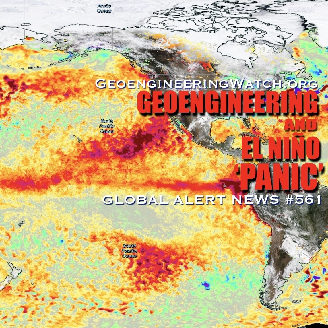
According to reports from NOAA, human-caused warming continued unabated into June of 2014 as land and ocean surface temperatures spiked to 0.72 C above the 20th Century average and about 0.92 C above 1880s norms.
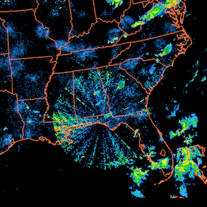
These new records were shoved higher by a broad warming of the ocean surface, not just an Equatorial Pacific approaching El Nino warmth, but also through an extreme warming of almost every major world ocean zone. This hot water warmed local air masses and had a far-reaching impact on global climate for the month, likely delaying the Indian Monsoon, worsening the western US Drought and intensifying the record wildfire outbreak in the Northwest Territory of Canada.
Widespread Above Average to Record Heat, Few Cool Areas
2014′s June rating beat out the previous hottest June, 2010, by about 0.03 C and showed an increase over the 1998 spike by about 0.05 C.
As global temperatures exceeded record levels, few regions experienced below average temperatures. These zones were primarily isolated to a region of the Pacific Ocean off the east coast of Japan and an isolated region in the southern Ocean between South America and Antarctica. Conversely, much of the globe experienced warmer than average or much warmer than average readings.
Widespread regions also experienced warmest on record temperatures with the largest of these zones stretching east of the Philippines across a broad swath of the Pacific, over a large patch of the Indian Ocean, and pooling off the East Coast of South America. Other smaller, but still extensive, regions of record warmest temperature emerged off the US and Canadian West Coasts, in a zone between the UK and Iceland, and over East Africa.
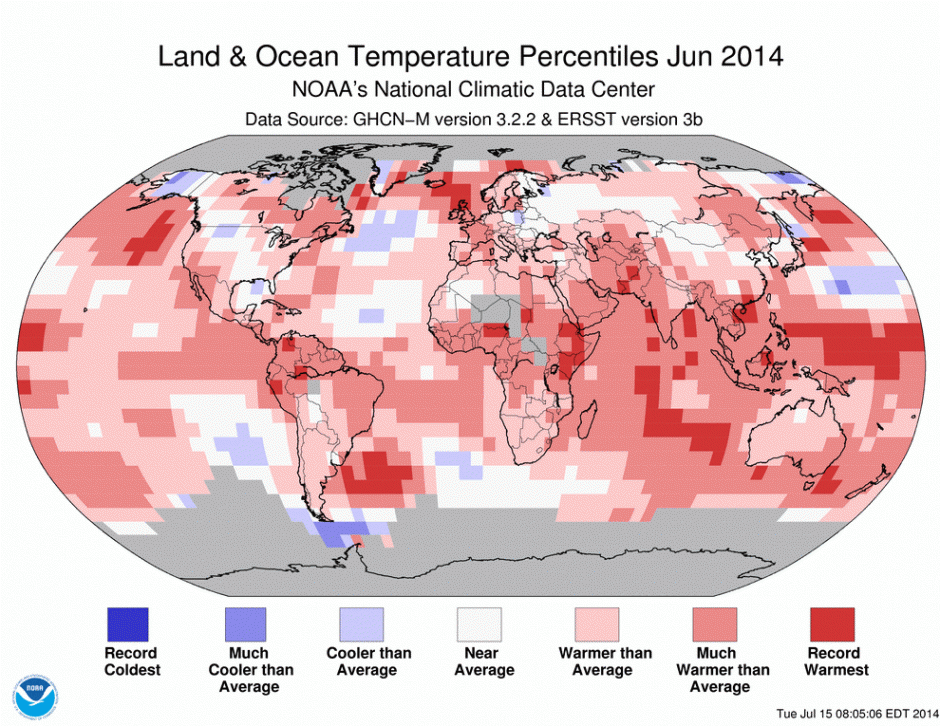
(Land and Ocean temperature graphic for June of 2014 shows most of the world sweltering under warmer than average to record warmest temperatures. Image source: NCDC.)
Other monitors also showed record or near record global heat for the month. NASA GISS marking the 3rd hottest June while Japan’s Meteorological Agency also put June as #1 hottest. Both May and June have now broken global temperature records in at least one of the major monitors and NASA shows that the first quarter of 2014 was also the hottest quarter since record-keeping began 135 years ago.
Record Temperatures in Context
Overall, atmospheric warming has continued at a pace between 0.15 C and 0.30 C per decade over the past three decades. Current warming of 0.92 C since the 1880s represents about 20% of the difference between now and the last ice age, but on the side of hot. Present atmospheric greenhouse gas loading of 400 ppm CO2 and 481 ppm CO2e, according to paleoclimate data, contains enough heat energy to raise temperatures between 2 and 3 C for the CO2 forcing alone, and 3 and 4 C for the aggregate forcing, over the long term.
Near 2 C or greater global increases will likely be achieved during this century even if greenhouse gasses are somehow stabilized. But rates of human carbon emission is now in excess of 30 gigatons of CO2 and approaches 50 gigatons of CO2e each year (when adding in all the other human-emitted greenhouse gasses). At this pace, we hit enough forcing to raise global temperatures by 5-6 C long-term and by about 2.5 to 3 C this Century within the next 20-30 years. Potential global temperature increases grow greater if humans continue to emit greenhouse gasses beyond this timeframe and if Earth Systems response to human warming is greater than expected (large CO2 and methane release from stores).
No El Nino Yet Despite Record Warmest Ocean Surface
The June record high readings occurred despite the Pacific Ocean remaining in an ENSO nuetral state. That said, sea surface temperatures in the Equatorial Pacific for the month of June did enter values typical to El Nino, so some ocean to atmosphere heat transfer likely occurred over this broad region and aided in the establishment of new records.
Globally, ocean surfaces were very warm through the month, at times hitting a +1.25 C positive anomaly above the 1979 to 2000 average. These were the hottest ocean surface values ever seen — a primary factor pushing over-all June temperatures to new highs.
NOAA has adjusted its El Nino forecast to show a higher likelihood that any declared El Nino is likely to be either weak or moderate. This is due to an overall weak atmospheric feedback (only intermittent westerly winds) to the initial ocean and near surface equatorial temperature spike associated with a strong Kelvin wave this winter and spring. Without continued atmospheric feedback, it appears possible that the predicted El Nino may well fizzle. That said, the NOAA forecast is still calling for an 80% chance of El Nino developing sometime this year.
Given raging sea surface temperature values outside of the Nino zones, even a weak El Nino would likely set the stage for a new record high global temperature for the year of 2014.
Source: Robert Scribbler