


Source: otterwalks
Methane deposits are abundant on the continental margin of the Pacific Northwest coast as more methane is seen being released southward. It is calculated that warming at this depth would theoretically destabilize methane deposits on the Cascadia subduction zone, which runs from northern California to Vancouver Island, as well as other areas heading southward along the west coast. The Ring of Fire, with its Geologic processes, is one action which creates fissures allowing this type of release. Other potential Action/Reaction, Cause and Effect potentials, will be addressed here.
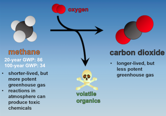
Here is a Link with more links to foundational research on the Methane GHG Issue. Methane is roughly thirty times more potent than CO2 as a heat trapping gas. There have been numerous Global Extinction Events over Earth’s history. Methane has been a culprit, the primary cause, in several of these events.
https://otterwalks.wordpress.com/2015/01/18/methane-release-global-warming-co2-taxation-psyop/
The Pacific Ocean’s cold temperatures, the presence of the subsequent high pressures that are present, created a state which holds methane gas in the seafloor sediments. This once stable methane formed a crystal lattice structure with water, resulting in an icelike solid, called methane hydrate. Methane Hydrate is unstable and sensitive to changes in temperature. When the ocean, or regions below warm, the hydrate crystals dissociate and methane gas leaks into the sediment. Some of that gas escapes from the sediments bubbling up most often. At times a massive release will create a plume such as this.
This is not the first – Plume Anomaly – which has been presented on Radar. When it turns up, I’ll add the link to the volcanic plume which originated out of the area southwest of Carlsbad Caverns, New Mexico. It was seen to travel NW through Amarillo and on to Oklahoma before it disappeared from Radar. Link to New Mexico Plume…
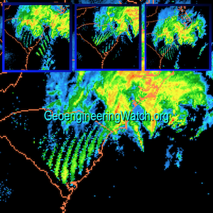
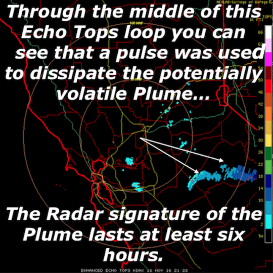
These are linear loops of this current event as they were first seen on Radar.
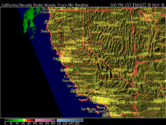
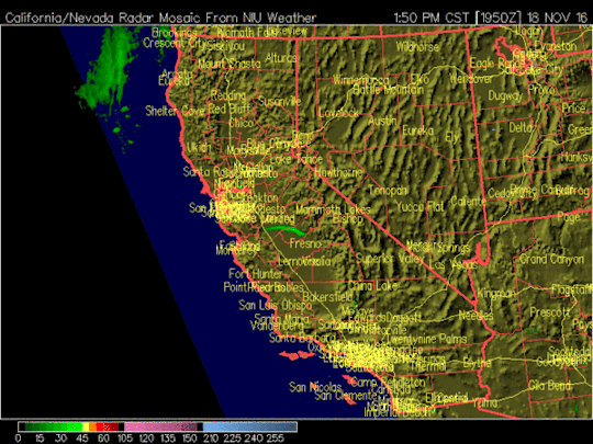
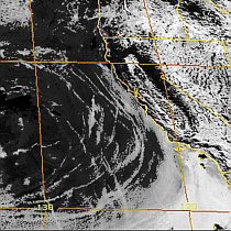
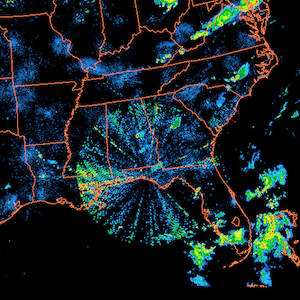
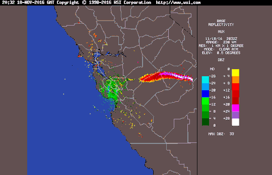
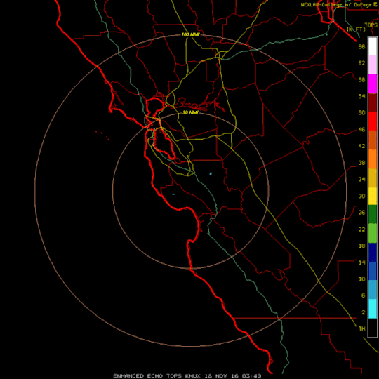
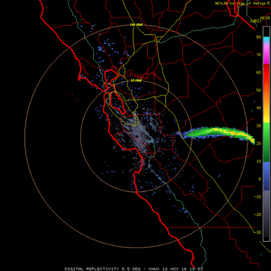
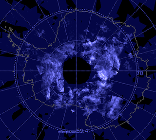
Double checking this oddity, these Intellicast returns quickly confirmed this Plume Event. Here, the NEXRAD single site Radar installation, KMUX – San Francisco, CA images the plume event. The plume was released offshore to the southwest.
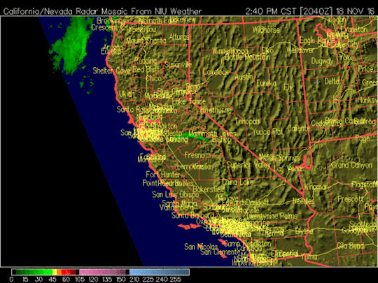
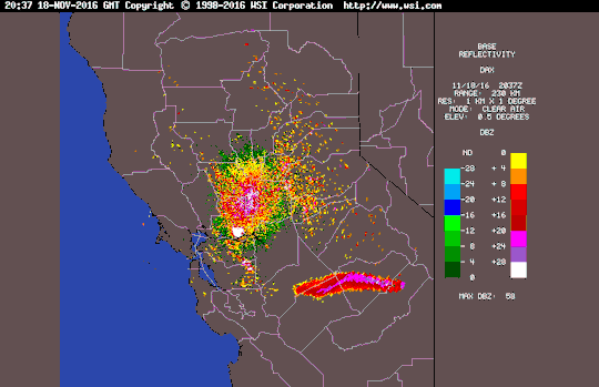
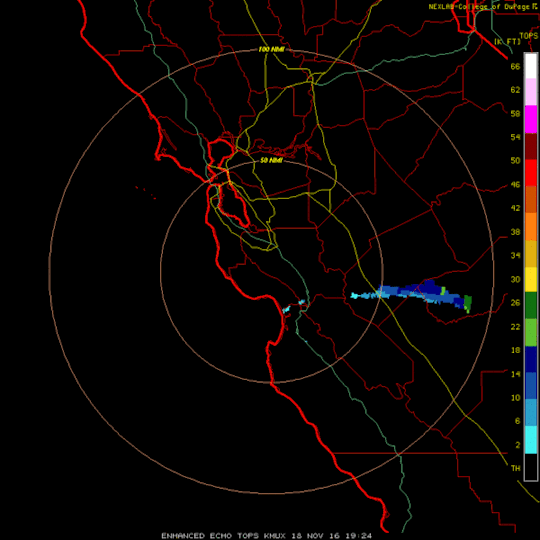
Next, as it traveled NW, NEXRAD KDAX designated Sacramento, CA picks up the plume. The legend shows the induction of High RF Frequency which may have aided in its disbursal. It also may be that It thinned to a point that Radar returns no longer showed it as the concentrated mass it had been.
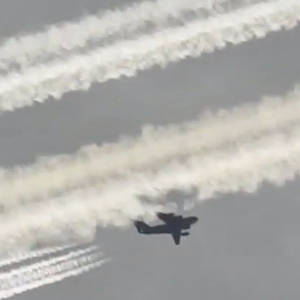
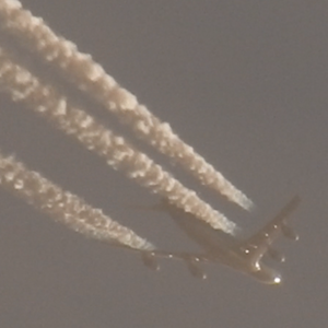
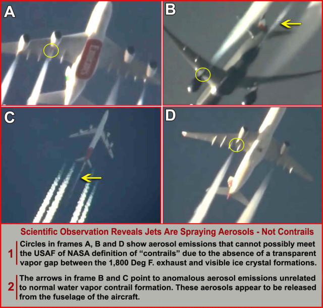
Imagine this floating in the atmosphere at the altitude most used by commercial air traffic. Do you think something might have happened between 20 and 30,00 foot when a jet flew through a massive cloud of Methane?
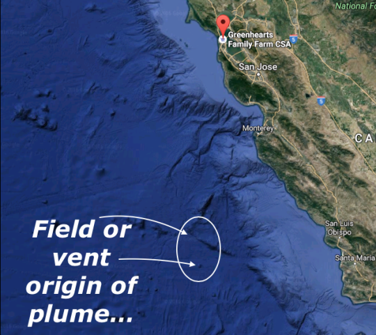
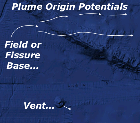
Looking at the satellite imagery in comparison with the first hints of the plume returned these areas as the origin of this release.

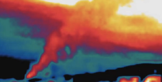
This is an IR image of the methane release that occurred inland at Aliso Canyon, CA near Los Angeles. The links are numerous. It continued for sixteen weeks. I don’t like the sources that are turning up in researching a good link for here, so I’ll let you do your own investigations.
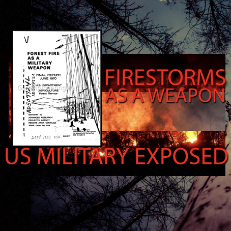
Granted this type of release can and does happen in nature over time naturally. Another issue is the uptake in Future Weapons A.K.A. Frequency Weapons deployment.
Decades of Frequency and Synthetic Plasmic experimentations, have through the action of Radio Tomography, enhanced this potentially natural destabilization of the offshore stable methane deposits. Like a Microwave oven on a small scale, frequency penetration of Future Weapons Technology excites the structure of these depths with a heating action. Cause and effect… Action begetting reaction. We are witness to the release of relatively permanently bound methane as the effect or reaction to the enhanced heating of once stable regions.
Here, an hour is wiped from the loop…
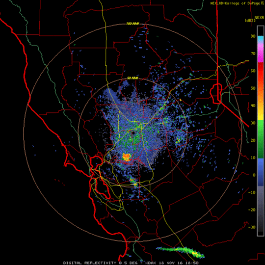
This is the first hint of the plumes origin… This is CoD – NEXRAD KMUX from what is known as the Base Reflectivity Product. It is imaged at a 0.5 degree angle.
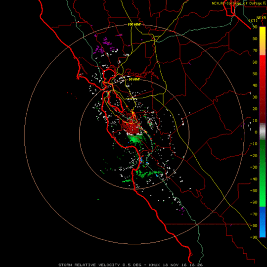
This is the KMUX Storm Relative Velocity Product return from CoD.
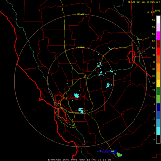
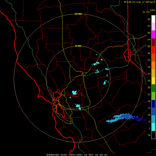
Here is KDAX in the Echo Tops Format. This legend shows elevations as well as frequency.
Then Gone…!
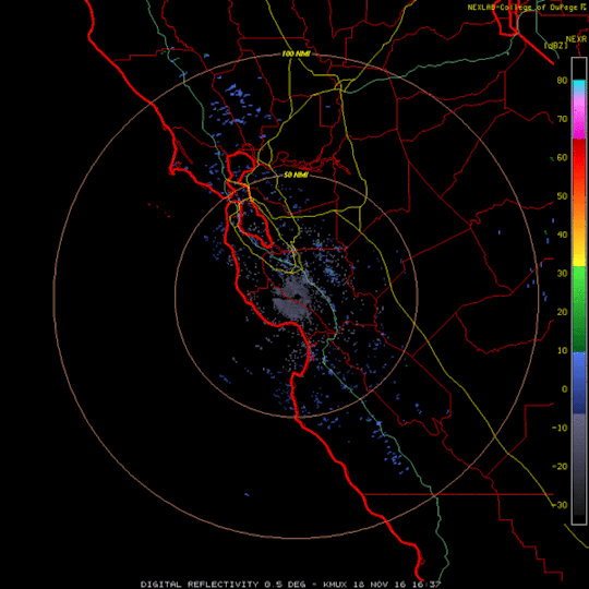
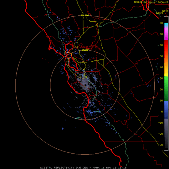
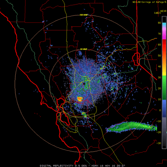
Back to the Northwest traverse… Continuing with a return to the Base Reflectivity, here from NEXRAD KDAX – Sacramento, CA.. Yes, that orange/yellow region is the site of the Rancho Seco Nuclear Generating Station. It is a decommissioned nuclear power plant built by the Sacramento Municipal Utility District – SMUD – in Herald, California. There is at least one article here that addresses the reason it is showing on Radar. Radiation…! It always appears for that basic reason. Here is a Link from 17th April 2015. You will see that nothing has changed… Note: The next two loops have been wiped and replaced several times. So, here you have them – again…
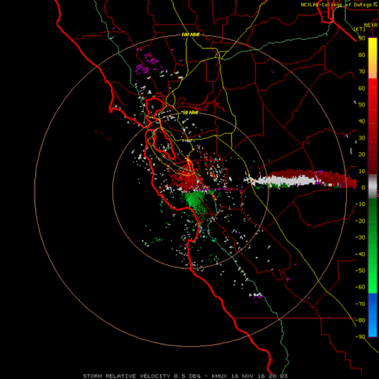
KDAX Storm Relative Velocity Product…
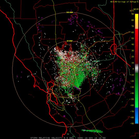
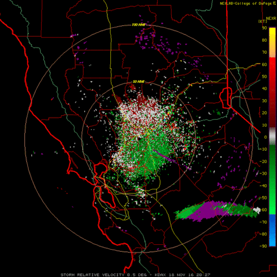
Above, as always, you can see that there is RF present that is so high that it is off of the chart! The legend has no magenta or purple color notation. This is more evidence of the induction used to minimally change the density and more likely negate this explosive plume as it rises and moves toward Reno from its offshore beginning.
This event has seen four days of intense research. A dust cloud has been ruled out as it came from the depths of the Pacific. It is a gaseous cloud; a Plume. It is rising as it moves inland from its origin. There are known deposits of Methane trapped off of the west coast of the U.S.. It’s formation was hit through the process of RF/EMF induction as it’s elevation reached the altitudes in use by jetliners. Conclusion…
All in all, the evidence is overwhelming that this was a Methane Plume. Frequency Weapons Experimentation are largely suspect in the Global Methane Release increase. Hence, a specific cause and effect exists that may well have had a heavy hand in its issuance.
There is a Global Future Weapons Arms Race being pursued at this time and it is escalating. The Arctic subterranean thaw which has brought forth the massive growing Methane release from deep permafrost beds may in fact be in a feedback loop. Directed Energy Weapons testing must be shelved until a time that these co-opted Mystic Tesla visions can be put to use for their origins intent; the use of Free Point Energy. This is the true path to a Real Sustainability regarding Energy Futures.
Source: otterwalks


6 Responses
To be added into your musings on this methane release:
Your slide (above) for origin of plume or field shows that it is directly west of San Luis Obispo and the site of the Diablo Canyon nuclear reactors run by PG&E. These are California's last operating nuclear reactors and they daily discharge huge amounts – 2.5 billion gallons from each of the two reactors – of thermally hot (20 to 25 degrees warmer than ocean water) and radioactively hot caustic chemical waste used for cooling water into the ocean.
Additionally, there are regular releases of radioactive fission gases (stripped from reactor cooling water to relieve build up of pressure) into the atmosphere, as well as periodic purges and venting of gases that have leaked into plant interiors, resulting in airborne gases.
Radioactive gases released: Iodine 131 (that which escapes filters); tritium (H3) with a radioactive life of 200 years and released continuously into sea as H30, taken up by plants and trees, partially incorporating into the ecosystem, and can by absorbed through skin, lungs or GI tract. (Carbon 14 routinely released in discharged water as well as gaseous effluents, with a radioactive life of 114,000 years).
Source: https://mothersforpeace.org/data/2015/2015-07-31-scoping-comments-milt-carrigan
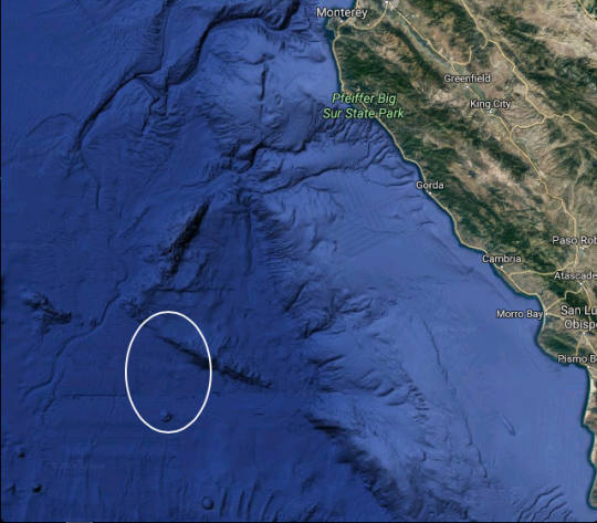
There is also a long earthquake fault paralleling the shoreline, called the Hosgri fault.
Perhaps some sort of synergistic effect occurred with the discharges and the earthquake fault.
Hello Otterwalks, I have been following your site & investigations for a few months, only stumbled by it, by accident.you are correct with your information and thank you for posting it out.
There also have been clusters of earthquakes at Nevada….there must be a connection? Earthquakes along the Gakkel Ridge releasing methane also. All this is covered up, no mention on any mainstream news anywhere.
As far as your Australian information there is constant activity at Port Headland – Karatha WA and Emerald QLD. There's one of those "radar" towers at the Airforce base at Townsville QLD too. It right on the coast line on a small headland, very visable. I have located the radar sites. I've been blocked form the weather site and can not download information on my computer. The Aust Govt have 2 major contracts with global defense companies who seem to "share" the same locations. Most are extremely remote, not easily accessable by road, most likely plane, they are so remote.
The Thunderstorm Asthma released on the Melbourne population is frightening, as it killed people. There has been no more coverage on mainstream media…nothing. Some chemical had to be released, that's the only thing I can think of that would cause such a reaction in so many people. Australia has the worst rate of Asthma in the world, not much of a suprise.
There is only one group in Australia on face book, I can find, that seem to actively talk about geoenginnering, but no where near the quality of information you or Dane release. Thank you.
@ Carrie from Aus… Thank you for the comment. Sorry, o… has not been available to respond. There are nearly ten months of archived Heater events to finish formatting and present. Much of it from Australia. I'm surprised to hear you have little or no access to Aus Radar. Weather Online was down for over a month, was back only to glitch out. As of today the 72 hour archive is back inline. We use 5 other sites and have had little issue. Their drawback is their 2 or 3 hour loop format.
Neither o… nor myself use Facebook or twitter. otterwalks has never used a cell phone. I am working on a new site on MINDS. It has been dubbed – Red Pill Media 42. It seems a viable Social Network. We will Link from there as the site is built up.
Hope to have some new CA data to pass along to our foremost activist gift to humanity, Dane. Thank you for your constant work.
May you all be well, Crew
Bigger Story in-between the lines!
The large orange blob is NOT Rancho Seco that would be a very small orange mark way to the east near Ione, the large blob is in the Delta actually east of the Concord Naval Weapons station and I suspect is actually PG&E Los Medanos Natural Gas storage wells leaking. also nearby to the east is McDonald Island NG storage facility and the general area is full of brown-fields, refineries and power plants and nat gas well activities along with natural decomposing islands in the Delta.I think you have a huge story here and proof of a major PG & E gas leak! https://www.pge.com/pipeline/about/system_maps/statemap/index.page
@Robert O'Connor… Crew here filling in for o… We had discussed this at length having seen this type of highlights around areas with military bases, WIPP, Cannon AFB, Dodge City, – Fort Dodge – as a few examples.
In researching Rancho Seco it was noted that it was located on the east side of Route 104. Now, we are not in the region, nor do we know anyone with the equipment to confirm our conclusions.
I will say that Rancho Seco is shown within 10 miles of 104. Keeping that in mind, Radar returns are layered composites. Different sites show the illumination overlay shifted west of Rt. 104. Ten to twenty miles is not much of an offset given the constant code evolution of these systems. Naturally it is mostly the addition of filters, negating data.
So, please forgive our best efforts researching this issue. Could it be another dumping ground? The respondent frequency image has remained the same for the last decade, maybe more. It's shape has not changed and gas is, I would posit, likely to shift forms; especially if it is leaching.
At any rate, thank you for your feedback. These consistent returns showing some unknown – ? -are worth our collective investigation.
Be well, Crew
Thank you, Dane, I am sharing this with Russ Tanner, OrbisVitae. Blessings on you and your family. Take care. You are a real trooper. Sincere blessings on you and your entire family. Press on!